Mobile Mapping & UAV

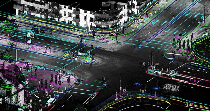
The mobile mapping team at GISTech is well experienced to provide end to end solution starting from mission planning to collection to processing and to extraction. They can process data form various devices irrespective of the instrument and manufacturer. They are capable of delivering highly detailed, voluminous and most accurate data in time.
In addition to data processing we are capable of carry out data collection from mobile mapping system collaborating with its partners.
Our Solution includes and not limited to
- Roads pavement and features including Central Median, Lanes, shoulders, Sidewalk, Street Lighting, Parking, Gutters, Manholes, etc.
- Street Furniture (Electricity Poles, Lighting Columns, Traffic Signals, Road Signs Street Name Plate, Notice Board, Manhole Covers etc.).
- Structures Including Bridges, Retaining Walls, Gantries, Safety Fence, Pedestrian Guardrail and Boundary Fence etc.
- Grit Bin, Litter Bin, Bin Storage, Fire Hydrant, Communication Cabinet
- Trees (Different type), Hedge, Vegetation
- Wadies /Rivers, reservoirs, drainage ditches, ponds, channels, culverts and other water bodies
- Tracks, Footpaths (Curb Line or Edge of Carriageways, Pedestrian Crossings, Traffic Islands, Parking).
- Electric Overhead Line, Substations, Transformers, Cabinets
- Side Slopes, Embankment, Quarries, Cliffs, Cut.
- Contours, Spot Elevations, Road Profiles
- Building, Boundaries, Walls
